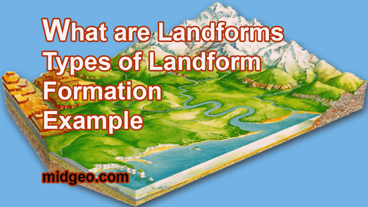
Landforms can be seen in different parts of the world, but what are landforms? Every part of the world has Substantial Types of Landforms.
In this article, I would like to discuss everything you need to know about your obvious idea about The World Landform. Be relaxed and continue reading.
A landform is a natural feature of the Earth, such as a volcano or a lake formed from the erosional processes of running water.
A landform is a large-scale alteration in land’s surface caused by physical processes or human action. Landforms are classified based on their empirical similarities and relationships to one another. A lobe is an example of a landform. List of Landforms A to Z on Earth
I will discuss the different types of landforms also love to help you better understand how landforms are formed.
Please share it with the superior and kindly share this content to stay updated.
What are Landforms?
What are landforms? Let me explain,
Landforms are the physical features found on the earth’s surface or its outer layer. Weathering, subsidence, soil washout, elevation, rainwater, and other natural processes give the earth’s landforms their closing shape.
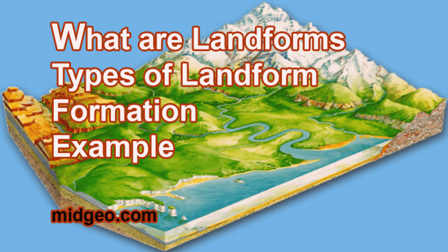
As these key landforms of the planet are generated through several geological processes, the development of these surfaces did not happen overnight and required millions of years to achieve the shape they have now.
Landforms are classified based on their natural characteristics, such as location, height, angle, layer, and production. On a scale fording from a few hundred meters to hundreds of kilometers, higher-order landforms such as mountains can be divided into progressively smaller homogenous units.
Types of landforms
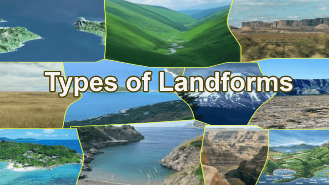
Considering their height, you can recognize landforms are two types:
- High Landforms
Some landforms rise dramatically over the surrounding region. Mountain ranges are the highest landforms, rising at least 1,000 feet above the surrounding terrain.
Hills are alike to mountains in that they rise above the ground, although they are not as tall.
A plateau is a third type of towering landform. A plateau, like a plate or a table, has a high flat top.
- Low Landforms
Plains, valleys, and canyons are examples of lower landforms. A plain is a large, open, flat area. Because it is easier to build on level land, most large towns are located on plains, and plains near rivers are great areas to cultivate crops like corn and wheat.
The low area between two mountains or hills is known as a valley. A valley formed by a river or stream has a V-shape, which may be seen by looking at its steep sides and narrow bottom. Other valleys are in the shape of a U with a rounded bottom.
MidGeo (Identifying Land forms)
MidGeo (Identifying Land forms)
Mountainous Landforms
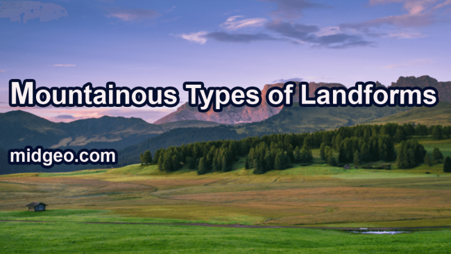
Mountain:
When you look at a mountain, you can see how it was formed by tectonic plate movements. The slow yet massive movement of the Earth’s crust formed between them. This is referred to as plate convergence.
When two tectonic plates come into contact, the rocks are pushed higher, resulting in the formation of a mountain range.
Example: A good landform example is the Himalayan mountain range. They were formed because of the collision between the Indian Plate and the Eurasian Plate. Which began 50 million years ago and continues today. So this is how the mountains are formed.
Types Of Landforms. Landform examples
You will also find many mountains near coastal areas. These are formed when a heavy oceanic plate collides with a lighter continental plate, the oceanic plate sinks beneath the lighter continental plate, which results in coastal mountain ranges. Like- the Andes Western coast, the Aleutians, the Japanese, and the Southern Alps.
Plateau:
A plateau is a flat, elevated expanse of land that rises above the surrounding land. There are two types of plateaus:
- *Dissected plateaus: dissected plateaus are formed because of upward movement in the Earth’s crust. One side of this plateau will have a slope. When two continental plates collide, that is how mountains are formed. Even plateaus are like mountains. Except it has a flat top. So even dissected plateau is formed because of the slow collision of tectonic plates.
- *Volcanic plateaus: It is formed causes of volcanic eruption, right? So I will write about it in the volcanic landform section.
Example:
A good plateau landform example is the Colorado Plateau in the US, the Tibetan Plateau, the Mexican Plateau in Mexico, and the Patagonia Plateau in Argentina.
Now erosion and rivers can influence the shape of a plateau. Even in the oceans, you will find plateaus. Ocean plateaus are of two types – one is made of continental crust and the other is made up of igneous rock. Because of the solidification of lava.
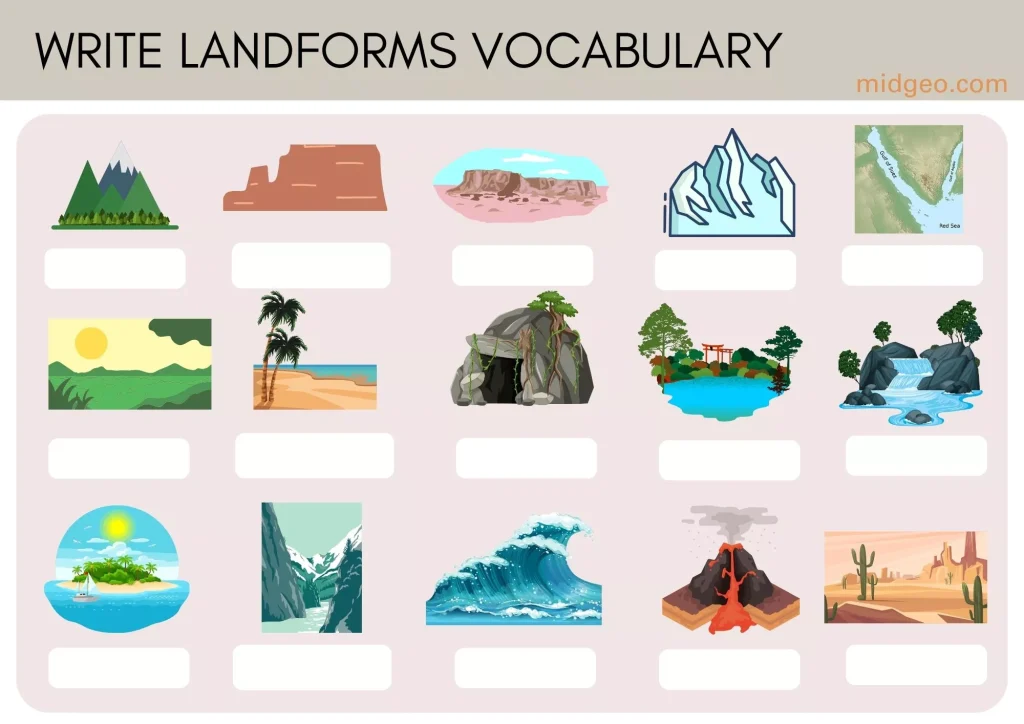
Free Printable Landforms Vocabulary Worksheet (Printable PDF for Free)
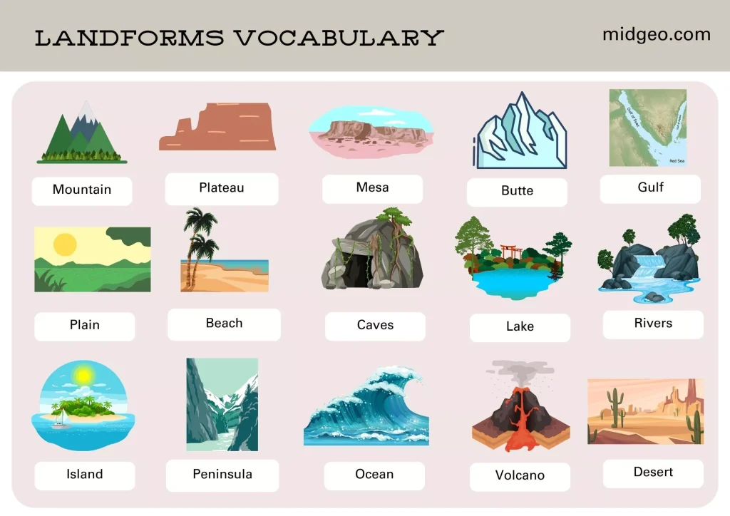
Mesa:
Now, you see, Mesa is also a plateau type of landform. An isolated flat top elevated landform, but the only difference between a Mesa and a plateau is that Mesa is formed after weathering and erosion of a plateau.
If I have to put it in order first comes a plateau after weathering and erosion a plateau gets converted into a Mesa and after more and more weathering and erosion a Mesa gets converted into a Butte weathering and erosion cuts the rock in a plateau and turns them into Mesa and Butte.
Butte:
Butte is an isolated hill with sharp vertical site sand flat tops boots are smaller compared to a plateau if you see boots are also plateaus but because of continuous erosion by water, rain, and wind.
They have turned into tall flat-topped landforms with a continuous flow of streams and wind activity.
Cuts a plateau in such a way that, from a plateau. It turns into a butte. They look like a tower and they’re created by erosion and weathering. We found buttes in Mexico and the southwestern side of the United States.
MidGeo (Formation Of Landforms)
Gulf:
A Gulf is a large inlet from the ocean into the landmass. The shape of the landmass is such that some part of the ocean water forms an inlet. Now, this kind of landform is purely natural, and they are formed by movement. In Earth’s crust, whenever we talk about movement in the Earth’s crust, automatically remember those three types of plate boundaries –
- 1.Convergence
- 2.Divergence and
- 3.Transform
When Earth’s tectonic plates crack or break apart or when one plate goes under another, these are how a gulf is formed. Saudi Arabia, UAE Qatar calls these countries like Gulf countries. The reason we can call these Gulf countries is that they are located around the Persian Gulf.
Gulf and a Bay are the same things, the only difference is in these sizes. A gulf is much larger than a bay. Its way of formation is also different.
Continental Plain
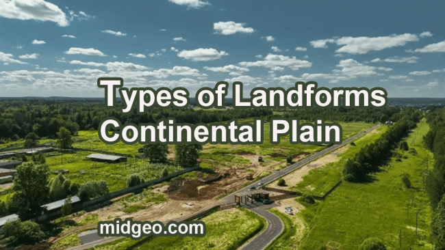
Plain:
A plane is a broad area of flat land. Planes are one of the major landforms on Earth planes. Form when ice and water flow over high-altitude landforms. On higher ground, water erosion erodes the dirt and rock. Sediment is dirt, rock, and other particles carried by water and ice.
Downhill side as layer upon layer of the sediment is laid down, and planes are formed.
- 10 Importance of Geography in the World: Why Studying Geography Matters for Individuals and Nations
- World Environment Day 2025: Date, Theme, and Significance
- Relative vs. Absolute Location | Definition & Examples
- What is a Beach? How Are Beaches Formed?
- List of Landforms A to Z on Earth
A good example is the North Indian clean river like Indus. Ganga has been depositing this for thousands of years, sediment has accumulated on this plain. Planes can be formed by volcanic activity as well.
When lava flows from a volcano, it covers the land in a dark-colored material called basalt, which gives the soil its color. Even this dirt breaks down into tiny particles over millions of years, which is how planes emerge as a result of volcanic activity.
Even flooding of rivers can form planes as river floods. It overflows its bank; the flood carries mud, sand, and other sediments out over the land. After the water withdraws, the sediment remains if a river floods repeatedly over time. This sediment will build up into a floodplain. Floodplains are often rich in nutrients and create fertile farmland.
the floodplain surrounding Africa’s Nile River has helped Egyptian civilization thrive for thousands of years.
In India, the regions near the Ganga River and Brahmaputra River are most prone to floods this state of Odisha also suffers from the flooding of the river Mahanadi.
The Mahanadi delta region just near the eastern coast of India is the most prone area to flooding. Another kind of plane is the coastal plains. Many rivers discharge silt into the ocean, which gradually rises above sea level, forming a coastal plain.
The eastern coastal plain of India near the Bay of Bengal is a notable example. Enormous rivers like the Mahadi, Godavari, Krishna, and Kaveri have deposited large amounts of sediment near coastal locations, and these coastal claims extend beneath the seas.
Plains are 5 Thousands to 7 Thousands meters below sea level, and that is why these Plains have not been thoroughly studied, but scientists say that these underwater Plains are among the flattest smoothest places on earth.
What are Landforms of Plains (MidGeo.com)
Tundra:
Tundra regions are placed at low temperatures, and you will find them in the North Pole. The Earth’s northern hemisphere is also with high altitudes. The land areas of North America, Europe, and Asia together are often referred to as the tundra region. Alpine Means Mountain in this ecosystem. Here will rarely find trees, mostly
- *Small shrubs
- *flowers
- *grasses
- *sedges
- *mosses
- *lichens.
The wildlife in this region includes
- Musk ox,
- Mountain goats,
- Snowy owls,
- Arctic foxes,
- Polar bears, etc.
The temperature of this region is mostly dry cold temperatures.
Iceberg:
When a gigantic piece of ice breaks from a glacier and reaches the open sea or ocean water, that is known as an iceberg. So, an iceberg is a large piece of freshwater ice floating in the open water. If you ever see an iceberg, only the tip of the iceberg is visible above water, While nearly 90 percent of it is underwater.
Fluvial Landforms
Beach:
When you look at the beach, you notice that this kind of landform is always next to a water body, maybe a sea or an ocean. Even next to a large river.
What is a Beach? How Are Beaches Formed?
On a beach, if you look at the land, you find that it is composed of sand rocks, shells, and pebbles. Moving water constantly erodes the land, and turns them into loose, and additionally, rivers and rainwater also erode rocks located further inland. These sediments flow through rivers and get deposited along the coastline.
When the waves of the ocean or sea continuously hit the shore. Every time the wave hits the shoreline. They erode the existing sediment and roll them repeatedly. If the waves are strong, they will spread the sediment along the coastline to create a beach. By the way, the shape of the beaches keeps on changing tides, and weather.
Canyon:
What is the canyon? When you imagine a large plateau. I have already explained how plateaus are formed. So, imagine a large plateau now try to carve this plateau with the help of rivers and glaciers.
So basically with time, the river erodes the bedrock of a plateau by cutting deep channels in the bedrock. The continuous flow of rivers and wind activity carves out of steep valley walls to form a canyon. This kind of process takes millions of years. So that’s how canyons are formed.
By the way, canyons are formed not only by cutting a plateau but also by mountains. Valleys are also like canyons, both of them are formed through erosion that is continuously worn down of the land by wind and water.
Caves:
The dissolution of bedrock formed caves. Rainwater reacts with carbon dioxide from the air, and as it penetrates through the soil, the rainwater turns into a weak acid. Now, this slowly dissolves the bedrock.
Bedrock comprises alternative rocks somewhere, you will find shale rock, and then somewhere you’ll find sandstone. In between these two, you will find limestone or dolomite.
When rainwater penetrates the soil, it turns into a weak acid, and it starts dissolving the bedrock by reacting with rocks like dolomite and limestone. As a result, long, hollow underground caves are formed.
Lake:
A lake is a body of water that is surrounded by land. Most of the lakes are fed and drained by rivers and streams which get water from rain, snow melting ice, and groundwater seepage. That means a lake is a low-lying land, which you can also call the basin. That’s how a lake will have water.
Lakes are found in every kind of environment, mountains, deserts, Plains, and near coastlines, lakes are both small and big. Small lakes are often referred to as ponds. Whereas a big lake can also be called the sea. The Caspian Sea in Europe and Asia is the world’s largest lake, then there is RLC Dead Sea Lakes are both freshwaters and saltwater but most of them are freshwater.
Saltwater Lakes usually exist near coastal lakes also vary in depth. The world’s deepest lake is Lake Baikal in Russia, nearly 2 kilometers below the surface. Lakes also exist at many elevations. One of the highest lakes is Lake Titicaca in the Andes Mountains between Bolivia and Pursuit is about 3810 meters above sea level.
How Lake Are Formed? Facts About Lakes In The World
Cliff:
If you look at a cliff, they are vertical and exposed Rock. An elevated piece of land forming. We found them near the coastal regions and river beds.
The major sedimentary rocks that form a cliff are dolomite, sandstone, and limestone. Even they are formed, and how mountains and plateaus are formed? That is, through tectonic activity. Now the rocks get hit by constant wind and water. As a result, they get eroded and weathered by the force of the water wave.
Continuously hits the cliff on top of it. The water is salt water; it dissolves the rocks quickly. Then a strong wind hits the cliff and erodes the rock particles slowly. The bottom portion of the cliff faces maximum erosion because of continuous hits by the sea and ocean waves.
This creates a dent in the lower portion of the cliff which is called a wave-cut notch. like the notch increases in size, the cliff becomes unstable collapses, and gets washed into the sea. This continuous process will make the cliff. Collapse and move the entire cliff further and further. Inland leaving behind a wave-cut platform.
Oasis:
In a desert, you will also find oases. Oases formed naturally or sometimes artificially.
Basically, in a desert, if you find a small region where water is on the surface, it is called an oasis. In a desert, the winds carry a large amount of sand in many areas of the desert. This kind of natural action creates land depression.
We got water from the ground. If people dig the Earth’s surface, it is called an artificial oasis, and when it occurs naturally, due to the wind blowing erosion or any kind of landslide which creates fault, and allows the water from the ground to reach the surface.
Because all it requires is to breach the upper thin layer of the ground that covers the layer that has water. Once it’s done, the water comes out on the surface, and that is how an oasis is formed.
Rivers:
How rivers are formed? Let me explain, Rivers are water that moves from high elevation land to lower elevation land with the help of gravity. The water on the higher elevation land can come both from rain as well as the melting of snow. After that, the water either gets absorbed into the ground or flows. Where there is a land depression, this kind of downhill flow turns the water into a river and lake. The river eventually ends up flowing into the sea or in the ocean.
Along the way, it erodes and weathers the soil, rock, and sediment, which changes and alters the face of a landscape.
Delta:
Delta now is called River Delta. These are landforms created by the deposition of sediment that a river carries. When rivers flow it carries a lot of sediments and rocks, Right? The greater the flow, the more sediment it will carry. As soon as the flow of the river slows down, sediments in rivers get deposited. Large heavier particles like pebbles, rocks, and sand are deposited first, after that lighter materials such as silt and clay get deposited.
So what I’m trying to explain is that you will find these Deltas where the speed of the river is slow. When the River starts to move slowly, that is when the sediment accumulates. Deltas usually occur where rivers enter an ocean. Sea estuary Lake, Reservoir, etc apart from these places, you will find delts at places where the river moves slowly.
In India, you will find deltas at all those places where major rivers meet the Bay of Bengal, for example, the Sundoorbon Delta, Godavari River Delta, Kaveri River Delta, Mahanadi River Delta, Krishna River Delta, and Peter Nika Delta.
Deltas Landform Examples
Waterfall:
A waterfall is basically a stream of water that flows over the edge of a cliff and then falls vertically downward. Waterfalls are formed when the riverbed changes from hard rock to soft rock, so what happens is that the river flows on two different types of platforms:
*hard layer of rock
*soft layer of rock
A river or stream flowing over a hard rock where erosion is slow and also flowing over the soft rock. Where erosion is rapid with time, the soft rock layer gets eroded and becomes a low-lying land.
Landforms can be seen in different parts of the world, but what are landforms? Every part of the world has Substantial Types of Landforms.
MidGeo.com
Now when the water flows on top of the hard rock and falls on these soft rock layers, it tends to form a plunge pool because the speed of the water increases because of the influence of gravity. At the bottom, you will notice that a plunge pool is formed. Further, it undercuts this soft rock layer as the undercutting continues. eventually, the overhanging hard rock becomes unstable and collapses. As a result, the waterfall slowly retreats backwards to the remaining lip of the hard rock layer.
Rain forest:
Rain forest can also be called a jungle. The most common meaning of a jungle is a land filled with natural vegetation and has avast lush green cover of trees, plants, grass, herbs, shrubs, etc. Apart from natural vegetation, you will also find a variety of animal species. In the world, most of the jungles can be found in the equatorial region and tropical regions. When we say, topics it lies between the latitude lines of the Tropic of Cancer and the Tropic of Capricorn.
The tropical region receives a very high amount of annual rainfall this is how the named rain forest came into existence. If you look at the main characteristics of a tropical rainforest,
- *These regions receive very high annual rainfall because the equatorial region is a low-pressure zone and the average temperature is very high, which is ideal for rainfall.
- *They have high average temperatures which provide moisture and humidity while the Sun shines almost equally in all parts of the earth, the equator is exposed to a high amount of direct sunlight, which is the reason behind high average temperatures.
- *These places have very little nutrients in the soil because the high volume of rain washes the nutrients out of the soil, and the existence of a large volume of trees sucks the nutrients out of the soil for growth.
The equatorial region is rich in biodiversity, that is why most of the biodiversity hotpots are in the tropical region.
Glacial Landform
*Glacier:
Glacier is a glacial landform.
How are glaciers formed? It is very easy to understand.
Glaciers begin to form when snow remains in this same area for a very long time. An entire year. This way, each year a new layer of snow is formed on the previous layers.
This compression forces the snow to recrystallize, meaning those tiny snowflakes become tightly packed together. As time passes, the density of this accumulated snow increases. If you go underneath a glacier, you will notice that the bottom layer of a glacier slowly melts. Most of the water recrystallizes and forms like a rock.
Most glaciers occur in high latitude and high altitude regions. Glaciers are usually formed on steep slopes. Glaciers are commonly found in high-latitude regions.
Antarctica and the Arctic region, which consists of places like Alaska which is in the United States, Finland, Greenland, Iceland, northern Canada, Norway, Russia, and Sweden.
Glacier is a glacial landform.
Fjord:
The F-Word is silent when you pronounce Fjord. these are long narrow deep. Inlet of this sea between high cliffs. They are created by glaciers. I just explain how glaciers are formed? Right. Glaciers move downlope very slowly over time and can greatly alter the landscape. Once they have moved through an area when a glacier starts to move, it carves the valley and forms a land depression. This carving of this T Valley is known as Fjord. A fjord is often deeper than the open sea. It can be thousands of meters deep. As a result, water fills up and forms a deep inlet of the sea.
A fjord is found mainly in Norway, Chile, New Zealand, Canada, Greenland, and the state of Alaska in the U.S. Fjords are home to several types of fish, plankton, and coral reefs.
Ice field:
In Antarctica, there are snow dunes that are formed by wind blowing snow into large piles as are silt they turn into ice hills.
Oceanic and Coastal landforms
What are Landforms? Types of Landforms | Landform Examples
Atoll:
Tiny sea animals called corals begin to build a reef around the island. These corals are very hard in nature it surrounds the island just below the ocean’s surface over millions of years. The volcanic island erodes and sinks to the bottom of the sea. Subsidence is the term for this process.
The seamount erodes into the sea and its top portion is made flat by the constant pounding of powerful ocean waves. Ultimately, the island sinks below the sea and all you can see is a ring-shaped island formed with a coral reef this is what we know as an atoll.
Bay:
A Bay is a broad inlet of the sea where the land curves invert a bay can also be called a gulf. But the only noticeable difference you will find is that a bay is semi-circular, whereas a gulf is a deep inlet. For example, have a look at the Bay of Bengal and the Gulf of Khambhat.
The Gulf of Mexico features a deep-sea inlet or ocean base that can be formed in a variety of ways.
- *Plate tectonics: the process of continents migrating together and apart causes the construction of several immense bays. Plate tectonics shaped the Bay of Bengal, which is the world’s largest bay. The Indian subcontinent collided and continues to collide with the enormous Eurasian Plate around the Bay of Bengal region millions of years ago.
- *When the ocean overflows a shoreline, bays are formed. The South China Sea overflowed the Kowloon Peninsula’s coastline, forming Kowloon Bay in Hong Kong.
- *Bays are formed as a result of erosion.
Many times, the ocean erodes the entire coastline, forming a bay. For example, Guanabara Bay is located in Southeast Brazil in the state of Rio de Janeiro.
Cape:
Cape is a narrow portion of land that extends into a river, lake, or ocean. Now, this narrow portion of land can be a part of a large landmass or it can also be a part of an island. Many geographers consider capes to be smaller than peninsulas. The only difference is that a cape is a narrow feature, and a peninsula is large. Cape is formed.
Coast:
The coast is a boundary where land meets water. It is also called as coastline waves, tides, and currents help create coastlines even reverse when they meet the sea or ocean. Rivers bring a large amount of sediment that gets deposited near the mouth of a sea or ocean. Where it naturally forms deltas, beaches, dune sand, barriers, islands.
When waves crash onto the shore. They erode the land and take away a large amount of sediment back into the sea or ocean, leaving behind shells, seaweeds, etc. Now, depending on what kind of land it is, for example, if it is hard granite land, then it is harder to erode.
- The Best Step By Step Guide How Are Guyots Formed – Landform
- How Are Glaciers Formed? Fun Facts About Glaciers?
- How Lakes Are Formed? Facts About Lakes In The World
- Landforms of fluvial erosion and deposition – River Systems
- What are Landforms? Substantial Types of Landforms, Formation, Example
Island:
An island is a piece of land that is completely surrounded by water.
Overall, there are four general ways that can explain the formation of an island.
- *When you take a look at the islands of Hawaii, they were formed by underwater volcanoes. The volcano erupted over thousands of years the land would go above the water, forming a seamount, and that is how an island is formed.
- *Tectonic activity plays a role in island formation,
- *An island is formed is through deposits of sand that came from erosion.
- *Islands can also be man-made. The country of Qatar is an island itself. The famous Palm Jumeirah is an artificial island in Dubai. In India, the Andaman and Nicobar Islands are of volcanic origin.
Archipelago:
The archipelago is also an island. But the only difference between an island and an archipelago is that archipelago is the plural form of an island. In other words, the archipelago is the name given to a group of islands. So an island is singular whereas an archipelago is a plural.
This means the group of islands most archipelagos are of volcanic origin. That means volcanoes erupting from the ocean floor formed the islands. These are basically sea mountains and the existent group. The Hawaiian Islands are a good example of a volcanic archipelago.
Isthmus:
The Isthmus is a narrow strip of land with sea on either side, forming a link between two larger areas of land.The Isthmus of Panama is one of the most well-known instances of the Isthmus landform. This Isthmus connects Costa Rica and Colombia via a small swath of land. Panama’s Islamists serve as a bridge between North and South America, as it lies between the Caribbean Sea and the Pacific Ocean.
Lagoon:
The simple definition of a lagoon is when a shallow body of water is separated from a larger body of water, like a sea or an ocean that is what is called a lagoon. If a lake is near to a sea or ocean and somehow the lake gets water from the nearby sea or an ocean, then we call it a lagoon.
Lagoons are of two types. At the center of an atoll, you will find a lagoon, and these types of lagoons are called atoll lagoons.
However, lagoons can also occur near coastlines these are called coastal lagoons.
There are two ways the coastal lagoon gets its water
*The coastal lagoon is connected to the ocean by a small stream. That’s how the lagoon gets its water supply.
*When the sea level rises.
The most famous lagoons in India include the Chilika Lake the Kalevala Lake.
Peninsula:
What is a peninsula? It’s a piece of land surrounded on three sides by water, yet connected to the mainland on the fourth. India, for example, is a peninsula country because it is bordered on the east by the Bay of Bengal, on the west by the Arabian Sea, and on the south by the Indian Ocean.
The fourth side is connected to a greater landmass. A peninsula can be formed by rising or falling of the sea level that may expose or cover portions of land to form a peninsula.
Even due to tectonic activity, up liftmen or falling of landmass may also help to form a peninsula, as a separation of land masses over millions of years can create a peninsula
Basin:
Some basins are filled with water and then there are ones that are empty they are formed over thousands of years or almost overnight. If it is through erosion when the ground gets eroded, it takes thousands of years.
A good example of an overnight activity would be an earthquake. earthquake makes the ground shake due to which a landslide is triggered and that’s how a basin is created.
A river drainage basin is an area drained by a river and all of its tributary’s heavy and continuous flow of water sinks some land and accumulates in other places this process is called erosion. The heavy and continuous flow of water picks up sand particles along the way, causing land erosion. The land that is taken away is now lower than the other land basins usually take thousands of years to form.
The Amazon basin in northern South America is the largest in the world. India has the Ganga river basin, Brahmaputra River Basin, Krishna River Basin, Mauna Dee River Basin, and Narmada River Basin.
What are Landforms? Types of Landforms, Formation, Example (MidGeo)
Ocean:
The Ocean is a vast body of water that covers a considerable amount of the Earth’s crust. Let’s look at the Atlantic Ocean as an example. Between North and South America on the left and Africa on the right, there is a lowland filled with water known as the Atlantic Ocean. That is to say, an ocean is a lowland between two continents. That are filled with water, so in a way, it’s a huge basin it is called the ocean basin. We cannot forget oceans because the reason earth looks blue is due to the oceans.
The surface of the earth is approximately 71% water and contains five oceans, including the Arctic, Atlantic, Indian, Pacific, and southern.
Sea:
If you look at the difference between a sea and an ocean. Seas are usually smaller and less deep than oceans. Whereas an ocean is a vast and continuous body of water, so basically the sea is smaller than the ocean.
Another point to notice is that a sea is partly surrounded by land, although a sea is an extension of an ocean. The moment water meets a continental landmass, the ocean water is called a sea. A sea is usually surrounded by a landmass. Therefore, the temperature of seawater differs from that of the ocean water.
Volcanic Landforms
Volcano:
Volcanoes are found when magma comes out within the Earth’s upper mantle. Now, how does magma come out of the Earth’s crust? It can happen in two ways-
- When two tectonic plates collide or when two tectonic plate moves apart now, you need to understand that tectonic plates are of two types-
- *a continental plate
- *the oceanic plate
When these two tectonic plates meet, three types of boundaries are found –
- Convergent
- Divergent and
- Transform
Several event scans show that a collision between two continental plates is possible. Mountains usually originated when two oceanic plates collided or when an oceanic plate collided with a continental plate.
2. When two continental plates converge or collide. If the same kind of plate collides, they crash like cars they typically Bend break and crumble creating folds and mountain ranges like the Andes Swiss, Alps, and the Himalayas.
A good example is the Ring of Fire in the Pacific Ocean, the Ring of Fire is a ring of volcanoes around the Pacific Ocean that result from the collision of oceanic plates with lighter continental plates.
Submarine volcano (Guyot)
When two tectonic plates move apart from each other, it is called a divergent boundary, it can occur between two oceanic plates or two continental plates.
When there is a divergent plate boundary in the ocean, in other words, when two oceanic plates are moving away from each other, molten basaltic magma from the mantle comes up and spreads on the ocean’s surface it is also called a mid-oceanic ridge. When magma comes out, it forms an underwater volcano or submarine volcano. The most famous example is the mid-oceanic ridge of the Atlantic Ocean, which divides the Eurasian Plate and the North American plate. divergence happens in two continental plates too –
- *Lava dome
- *Lava field
- *Lava Plateau
Volcanic plateaus are formed by numerous small volcanic eruptions that slowly build up over time, forming a plateau anyhow a plateau is an elevated piece of land.
When lava continuously comes out of a volcano over time, it accumulates in the form of layers and that is also another way how plateaus are formed.
Some landform examples of volcanic plateaus are the Columbia Plateau in the northwestern United States of America, the northern islands of New Zealand in India, the Malva plateau, and the Deccan Plateau is a volcanic origin.
What are Landforms? Types of Landforms Example
Geyser:
Geysers are like hot springs. Where warm surface water comes out of the ground.
So how does the water become so warm when surface water comes in contact with rocks that are heated by magma this is called geothermal heated water it then rises towards the surface by the process of convection and this warm water comes out of the surface through porous and fractured rocks you will find many geezers around the world located near rivers because that is where the groundwater is adequate if you want to trace the source of these geezers. many geezers are located at the edges of tectonic plates
- *Caldera
- *Crater lake
Aeolian Landformes
Desert:
when we think of a desert, this kind of sandy picture comes to our mind, right? But then that’s not the only desert.
There are basically four types of deserts–
- The first one is in the subtropical region. It’s the subtropical region it is due to top pressure differences and circulation patterns of air masses that hinder the formation of clouds. That is why there is very little rainfall on the land which eventually causes subtropical deserts basically a subtropical region is a high-pressure zone.
- The second type of desert is rain shadow desert so there are two sides of a mountain one is the windward side and the other is a leave outside. As a result rainfall occurs and leave outside is the opposite side where it is dry and there is no wind that means it is very little or no rainfall at all. On the leeward side of a mountain so these semi-arid and cold winter deserts are found on the leeward side of a mountain. Examples of rain shadow deserts are Mongolia’s Gobi Desert, the eastern part of western carts.
- *The third type of desert is coastal deserts. when cold ocean currents blow towards the shore these winds are cold because they are in contact with cold water and they produce a layer of fog which is a thick cloud of tiny water droplets that are too small to fall as rain now this heavy fog moves on to the land but the sun’s heat makes them disappear during the day since there is no rain the coastal region turns into a desert some examples of coastal desert includes the Namib Desert in southwestern Africa and the Atacama Desert in Chile.
- The fourth type of dessert is called in polar desert. Examples of polar deserts are Antarctica, Alaska, Canada, Greenland, and Norway, Sweden, Finland, Russia, in India we have Ladakh which is a cold desert even Mongolia’s Gobi Desert is a cold dessert but it is also a range hydro desert Patagonian desert in Argentina is also a cool desert.
Sand dune:
Dune will find in deserts and beaches they are formed by the wind. When the wind blows and it gets accumulated at one place and forms a pile or stack of sand. These is what is called dunes. Every dune has a windward side and a slip face windward side is the side. Where the wind is blowing and pushing the material up hay dunes slip face is simply the side without wind, a slip face is usually smoother than a dune’s windward side.
Sand hill:
Even a sand dune in the desert is a hill it is called a hill of loose sand or Sand hill.
Artificial Landforms
- Artificial island
- Artificial reef
- Bridge
- Building
- Canal
- Dam
- Ditch
- Levee
- Polder
- Quarry
- Road
- Tunnel
Some other Types Of Landforms
Strait:
- *Tectonic activity can be one reason if you look at the Strait of Gibraltar it is the only link between the Mediterranean Sea and the Atlantic Ocean it was formed by tectonic activity between the Eurasian and Africa plate when they drifted apart another way or straight can be formed is by
- *Human activity if it is done by humans then we also call them canals. the Suez Canal is a good example it connects the Mediterranean Sea and the Red Sea.
Overflow of water the third way by which a strait can be formed is when a body of water over flows on the land and completely erodes the land and drowns it if you look at the Strait of Bosphorus it links the Black Sea and the agency the Strait of Bosporus is an extremely important strait separating the continents of Europe and Asia.
- 10 Importance of Geography in the World: Why Studying Geography Matters for Individuals and Nations
- World Environment Day 2025: Date, Theme, and Significance
- Relative vs. Absolute Location | Definition & Examples
- What is a Beach? How Are Beaches Formed?
- List of Landforms A to Z on Earth
Marsh:
Marsh is basically a wetland. if you look at the area it is a low-lying land which gets filled with water during rainy season or from rising water levels of a river lake or stream. So, how does a land becomes a low-lying land through continuous erosion processes or through deposition of sediment on nearby lands during floods. A marsh is always covered with water throughout the year.
you will mostly find marshes at the edges of rivers, lakes and streams. vegetation these places are dominated by grass and other herb aceousplants. you will not find trees the seplant roots holds the muddy soil tightly and slows down the flow of water this is how marshes are flooded with water. The world the famous rancher Convention on wetlands is a good example
Sound:
Sound is a geographical term please don’t think of it as a sound wave.
A sound is a large sea or an ocean Inlet that separates two land masses. sound is a large depression of land which gets filled in with sea or ocean water. Also it is much wider than a jawed. you will find a sound only near the coastlines of the world and the water is from sea or ocean that means it is a saltwater land form
Prairie:
Prairies are basically flat fertile lands dominated by crosses you can also call them grasslands. Grasslands are known by different names in different parts of the world.
- *In Asia and Europe it is called steppe ease or taiga,
- *In North America it is called prairies
- *In South America it is called pampas Lanos and serra dos
- *In Africa they are called Savannah’s and wells and
- *In Australia they are called Range lands or downs
The grasses of these grasslands hold the soil firmly in its place that is why erosion is very minimal. Majority of the grasslands around the world are found between 40 degree and 60 degree north and south of the Equator that. Means you will find the grassland in temperate zone. that is why they are called temperate grasslands. Mostly Prairies find these grassland very near to a hilly or mountainous region because these area are a perfect rain shadow region that means the amount of rainfall is very low. As a result, here the vegetation is in the form of grass and not in the form of tall trees.
Landforms are a type of surface with a definite form, or with a definite or indeterminate form, which displays particular character. Landforms have shapes that vary according to the sedimentary rock.
Last of all, Thanks for reading “What are Landforms? Types of Landforms” – Stay updated and learn more about our beautiful world. Please don’t forget to share. And if you need more help, comment me in the box below. Best of luck!


